


 |
|
From top: The colourful village of Mont-Tremblant is also busy during the summer months; ski villages are popular destinations. |
When most people—especially Montrealers—talk about going to “the Laurentians” they are referring to the rugged but pristine recreational and wilderness areas in southwestern Quebec, including the impressive ski hills and trails in and around Saint-Sauveur, Val-David and Mont-Tremblant.
What is not widely known is the fact that “the Laurentians” are part of a much larger area that is rich with history, including generations of settlers who have discovered opportunity in a landscape that has not been friendly to agriculture. This larger area is known as the Laurentian Highlands, a formidable landmass that stretches from the Gatineau and Ottawa rivers in the west to well beyond the Saguenay River in the east, rising 400 metres in height to a maximum elevation of over 1,000 metres north of Quebec City in Laurentides Provincial Park.
The Highlands corresponds to most of what geologists call the Grenville geological province, one of the major landforms comprising the province of Quebec. It is viewed separately because it contains rocks and structures that differentiate it from Quebec’s other major landforms.
From a tourism point of view the Highlands incorporates specific attractions in several distinct areas, including the Laurentides, Outaouais, Mauricie, Quebec City and Area, Charlevoix, Saguenay–Lac-Saint-Jean and Manicouagan.
It was into the Laurentian Highlands that early explorers and fur traders went in search of new land and new wealth. It was in the forests of the Highlands where lumber was king and huge rafts of squared timber raced down rivers to market in Montreal and Quebec City. And it was in the Highlands’ valleys where settlers tried farming, creating small towns and pushing the northern boundary for growing crops before moving on to work in the big mining, manufacturing and hydro-electric developments. While hostile to agriculture, most of the terrain was ideal for outdoor recreation. Now it is mainly nature and the healthy outdoor life that attracts settlers and visitors.
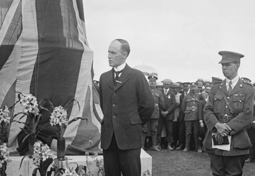
The nature poetry of Canadian writer and World War I chaplain Frederick George Scott gained the beloved padre election to the Royal Society of Canada in 1900 and the sobriquet Poet of the Laurentians. Scott drew inspiration from the lonely, stark beauty of the region and, in the opening lines of his sonnet The Laurentians, wrote:
These mountains reign alone,
they do not share
The transitory life of woods and streams;
Wrapt in the deep solemnity of dreams,
They drain the sunshine of the upper air. The Highlands has the largest exposures of Precambrian rocks in the world. These one- to two-billion-year-old relics are metamorphosed granite and gneiss (pronounced nis) that have been subjected to heat and pressure, uplifted and eroded by time and the effects of glaciation. Drainage in the region was affected, resulting in the maze of large and small lakes, marshy hollows, dramatic cliffs, rocky outcroppings, winding streams and swift-flowing rivers with rapids or waterfalls.
With its scoured bedrock, uninterrupted boreal forests and cool, damp climate the area is a primal landscape. The aerial view is a dense panorama of dark evergreen interspersed with lighter green deciduous trees such as sugar maple and beech, brownish-yellow bogs and gray rocks. The boreal ecosystem is represented by mixed forest with dominant black spruce and balsam fir in the south, including stands of white birch where logging and fires have taken their toll, to treed wetland and northern coniferous-moss woodland. Two huge meteor craters, the Manicouagan and the Malbaie, dent the land with circular depressions. The former—located approximately 500 kilometres northeast of Quebec City—has been flooded by hydro-electric power generating dams and is readily spotted on a map as a cluster of lakes.
The first European explorers were trappers and traders working for the Hudson’s Bay Company and North West Company. They were followed by settlers such as Philemon Wright who brought his little band of loyalists from a farming community near Boston, Mass., to form Wright’s Town or Wrightville (subsequently Hull and now Gatineau) near the Chaudière Falls on the Ottawa River in 1800. After clearing the land, settlers endeavoured to sell the logs and float them downriver. Their water-powered sawmills that produced squared timber and planks set the stage for lumber barons like J.R. Booth and E.B. Eddy in the latter part of the 19th century. But, while the timber titans made fortunes, most lumbermen and labourers lived in poverty. As technology advanced, Highland rivers were harnessed to produce electricity. Other operations like textiles at Lachute and St-Jérôme as well as pulp and paper at Shawinigan and Grand-Mère helped expand the industrial base. Rich mineral deposits of silica, lime, dolomite, copper, gold and nickel were the basis of a prosperous mining industry.
Around the Saguenay River and its tributaries was a wealth of water power, forest and mineral resources that has evolved to make it one of the most prosperous areas in the Laurentian Highlands and in Canada. Today, huge ocean-going ships can move far up the Saguenay fjord directly to aluminum smelters and pulp and paper mills that ship around the world. Electricity generated from immense dams power these industries but, in 1996, the power of the Saguenay became destructive as floodwaters, caused by torrential rains and overflowing dams, washed away homes and lives that had been established for over a century.
An early group of Irish and Scottish settlers in the mid-1800s, faced with a shortage of arable farmland to the south, had attempted to develop agriculture in the lower valleys of the western Highlands. But, except for a few sandy expanses in the plateau region that are marginally useful for agriculture, the thin, stony soil, poor drainage and cold climate severely limit the range of crops. A second wave of French settlers in the late-1800s, enticed by the colonization dreams of Curé Labelle, were less successful in scratching a living from the land.
François-Xavier Antoine Labelle was born in 1833, the son of a Ste-Rose shoemaker. After his ordination in 1856 he was assigned to the rich parish of
St-Jérôme, where he promoted his vision of French-Catholic colonization northwest through Ontario all the way to Winnipeg. An imposing man over six feet tall and 300 pounds, he spoke with conviction and authority and became known as the Apostle of Colonization and the King of the North with powerful political connections in Quebec City and Ottawa.
St-Jérôme became the base for launching development up the Nord and Rouge river valleys but Labelle’s Laurentian colonists found logging in the bush in winter and farming rocks in summer a difficult life. Within two generations, most of the marginal farmland had been abandoned as the colonists moved to jobs in the mills and factories back in the south. Labelle believed a train was needed and he convinced Montreal investors to construct a rail line. The Chemin de la Repousse—nicknamed Le P’tit Train du Nord—would run to St-Jérôme and eventually right through his settlements to the north. Unfortunately, Labelle died in 1891, the year before completion of the rail link to Ste-Agathe-des-Monts.
While the railway did not rescue Labelle’s original dream it did bring in a new era of holiday and recreational development. By 1894, the area around Ste-Agathe-des-Monts was already attracting seasonal vacationers from cities like Ottawa and Montreal and from as far away as the United States. By the 1920s, tourists of all income levels came to the resorts and cottages of the Highlands to hunt, fish, swim, sail and ski. Modern roads like the Laurentian Autoroute north from Montreal, built in the 1960s, and the Trans québécoise Autoroute to the
St-Maurice River valley provided easier access to the recreational riches of the Laurentian Highlands.
With a rails-to-trails conversion, the year-round P’tit Train du Nord linear park along the former rail bed was opened in 1996 and runs 200 kilometres from
St-Jérôme to Mont-Laurier, situated approximately 150 kilometres north of Montreal. In the summer and in the leaf-viewing Laurentian autumn, it is a popular route for hikers and cyclists. In winter, the area’s heavy snowfall makes the 45 kilometres of groomed cross-county trails and network of snowmobiling tracks a choice destination. The southern part of the trail has the most usage and the most amenities; the northern part is more of a wilderness experience. For convenience and comfort, there are plenty of snack bars, washrooms and parking areas as well as accommodations and campsites. Many of the renovated train stations have new life as cafés, tourist offices with historical exhibits, equipment rentals and even an art studio. A free guide booklet is available from the Association Touristique des Laurentides by telephoning 1-800-561-6673.
Covering 1,150 square kilometres in the Laurentian Highlands, Mont-Tremblant Provincial Park is a year-round tourism destination that is also a mountain, a town and a resort of the same name. As the largest park in Quebec, it has some 400 lakes with trout, pike and lake char, 163 kilometres of hiking trails and six rivers among rolling hills and forests. It also has 194 species of birds, including the bald eagle and rare Bicknell’s thrush, and 40 species of mammals like white-tailed deer, moose, black bear and wolf. Summer canoeing, camping, biking and hiking are replaced by cross-country and downhill skiing, snowboarding, snowshoeing, snowmobiling, skating and dogsledding.
Large ski resorts have been developed in the Highlands, most notably at Mont-Tremblant (968 metres high) in the Laurentians northwest of Montreal and at Mont-Sainte-Anne (815 metres high) north of Quebec City. Mont-Tremblant is just one of many resorts along the route through St-Sauveur in the lower Laurentians to Ste-Agathe-des-Monts and St-Jovite. It began in the 1920s when Norwegian skier Herman “Jackrabbit” Johannsen laid out many of the cross-country ski trails, starting what is today the largest industry in the region. Downhill skiing began in the 1930s when the first mechanical lift in North America was installed.
From the historic days of ski trains dropping off weekend Montrealers who were then met by horse-drawn sleighs, the area now has ultra modern facilities replete with bars, bistros, night clubs and restaurants. An outdoor adventure to welcome early spring occurs every March during “sugaring-off” when maple trees are tapped and the sap boiled down in a sugar shack—cabane à sucre—then served in a dining hall with music, dancing and traditional Quebec delicacies such as ham, baked beans, crêpes, eggs poached in maple syrup and maple taffy on snow. Maple syrup from the area is sold across Canada and around the globe but many sugaring-off cabane à sucre operations are part of family farms. The owners bring in extra income by welcoming visitors and offering sleigh rides, educational tours and other rural experiences to school groups and tourists.
The ski season on the eastern side of the Highlands is the longest in eastern North America, stretching from November to May. Mont-Ste-Anne—east of Quebec City—has the highest vertical for night skiing in Canada. The resort, with a view of the St. Lawrence River to the south and the mountains to the north, is host to international ski and snowboard competitions. Close by is the Ste-Anne-de-Beaupré Basilica, a popular pilgrimage destination, and Montmorency Falls, named by Samuel de Champlain in 1613 in honour of Henri II, duc de Montmorency, who served as Viceroy of New France.
The narrow falls are 76 metres high, the highest in the province, and more than 20 metres higher than Niagara Falls. Since walking down is easier than hiking up, most visitors choose to take the cable car to the top lookout or belvedere then walk down the 487 steps on the opposite side of the falls past Paleozoic rocks and Metamorphic outcrops.
Historic Tadoussac near the mouth of the Saguenay River, a 10,000 year-old fjord with cliffs gouged by glaciers out of the surrounding granite Highlands, has become a bird and whale watching mecca. More than 11/2 kilometres wide and 270 metres deep at some points, the icy waters abound in microscopic plankton. Beluga, minke, finback and great blue whales come every summer to the now-protected Saguenay-St. Lawrence Marine Park, an area that was an ancient hunting ground for native peoples and a Basque whaling station years before Jacques Cartier first arrived in 1534. Tadoussac is also home to the Old Chapel, also called Chapelle des Indiens. Built in 1747, it is the oldest wooden church in Canada. In the air, the Observatoire d’oiseaux de Tadoussac, has some of the highest counts for individual species of all North American hawk-watching sites.
Along with tourists comes the need to feed, house and entertain them. The Highlands feature many small inns, bed and breakfasts as well as grand old hotels such as the Château Montebello or Manoir Tadoussac with European ambience and chefs who create cordon bleu meals. Visitors can also choose to stay at a resort condo, chalet or campground, stop in at a pâtisserie (bakery), a fromagerie (cheese shop) and a dépanneur (convenience store) for a bottle of wine and make their own meal. Most small businesses are either family-run operations that have been passed down through the generations or are owned by urban émigrés seeking a simple country lifestyle.
The harsh life of the original settlers in the Laurentian Highlands has now been replaced with the back-to-nature lifestyle of people who could live elsewhere but who have chosen to live in an area to which they feel a personal affinity. The old riches of the Highlands were in the lumbering, mining and processing of its natural resources; the new riches are also in its natural resources but in renewable eco-tourism, agro-tourism and recreational-tourism. Success in this new direction could also threaten the delicate environment of the area but current inhabitants know how intricately their well-being is linked with that of the land.
Advertisement