![A Canso noses up to the eastern Arctic shoreline. [PHOTO: ERNIE WEEKS, CANAV BOOKS COLLECTION] A Canso noses up to the eastern Arctic shoreline. [PHOTO: ERNIE WEEKS, CANAV BOOKS COLLECTION]](https://legionmagazine.com/wp-content/uploads/2010/06/HallidayLead.jpg)
“It is considered that North West Air Command should examine the Northwest Territories in the interests of the safe and efficient conducting of air, land and sea rescue operations in the future. Such action is considered to be in line with the recent Cabinet Decision that the RCAF is to be responsible for the co-ordination of all air, land and sea rescue.”
So began Operation Order No. 207, dated Feb. 21, 1946, a directive from Air Force Headquarters to North West Air Command (NWAC) for a study of potential air/sea rescue bases throughout the N.W.T. It was to be a shoestring affair. The NWAC was told it would have to use its own resources and that some supplies would be available at bases vacated by American forces. No additional navigational aids would be forthcoming, however, and major aircraft overhauls or modifications could not be guaranteed.
Any logistical help from the Hudson’s Bay Company would be limited because the firm had few ships, and their schedules had to be determined a year in advance to wring maximum use from the short navigation season. As of March 19, 1946, Air Commodore C.R. Dunlap reported: “All efforts to ship petrol to the Eastern Arctic via the (Hudson’s Bay Company ship) Nascopie have failed as the deck space of the steamer is fully encumbered for the current season. This means that no caches will be available in the Eastern portion of the Northwest Territories, other than at Southampton Island, where a stock of roughly 50,000 gallons of 100 octane fuel is held for the Survey Wing, and at Crystal II, Frobisher Bay, where the Americans still hold considerable stocks of fuel of the same rating.”
It was suggested that aircraft supporting Operation Muskox, a joint army/air force expedition from Churchill, Man., to Edmonton, might deliver fuel to Holman Island, Coppermine and Cambridge Bay, but on April 3 it was decided to concentrate a fuel cache of 2,000 gallons at Cambridge Bay.
Plans for Investigator, as the operation was called, had to be flexible because they were dependent on the pace of the northern ice breakup. The first phase, expected to begin June 10, called for two Norseman and one Canso aircraft to proceed to Lake Athabasca, selecting a base site near Goldfields or Stoney Rapids in northern Saskatchewan. They were then to proceed to Port Reliance, choosing a base site there, before making a similar selection on Great Bear Lake in the Northwest Territories, preferably close to steamer facilities at Port Radium.
The second phase, scheduled for July 1, envisaged the Norseman aircraft moving to Aklavik to reconnoitre the Arctic coast from Herschel Island in the Beaufort Sea to the mouth of the Anderson River at Wood Bay. Meanwhile, a Canso would transport fuel from Norman Wells to Coppermine. Once a cache had been established there, the Norseman crews would extend their surveys eastward to the mouth of the Burnside River and northwards to Cambridge Bay, Walker Bay and Holman Island.
![Stanley O. Partridge. [PHOTO: NATIONAL AVIATION MUSEUM] Stanley O. Partridge. [PHOTO: NATIONAL AVIATION MUSEUM]](https://legionmagazine.com/wp-content/uploads/2010/06/HallidayInset1.jpg)
The third phase was contingent upon findings from the second phase as well as ice conditions. The objective was to check potential base sites further north. In particular, the Norseman crews were to establish themselves on the northern coast of Banks Island, from which they would examine the area of the Northwest Passage, including Melville, Bathurst and Cornwallis islands. The Canso would deliver fuel from Holman Island and then establish northern caches at sites to be determined. From there the surveys would be extended eastward to Bellot Strait. It was expected that by Sept. 1, all aircraft would be south of the Arctic Circle.
Operation Investigator took shape with the issuance of a further operation order May 29, 1946. No. 6 (Communications) Flight, based at Edmonton, was to supply two Norseman fitted with long-range tanks and one Canso; one additional Norseman and one Canso would be held as reserves at Edmonton. To ensure maximum range, the Norseman crews would consist of a pilot and a mechanic. In the interest of safety, flights would be conducted with the Norseman crews constantly in sight of one another.
Participants were given detailed instructions as to choice of potential bases. At each site they were to report on local climate, hills, prevailing winds, existing settlements, available power, water, wood, fish and game supplies. They were to note existing communications systems, including radio, radar and weather stations. In the case of seaplane bases, they were to note approximate breakup and freeze-up dates, depth of water, currents, tides, beaches where aircraft might be hauled ashore, and the availability of boats.
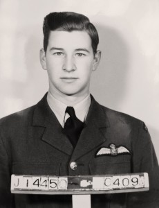
As of June 19, 1946, the personnel for Investigator had been chosen. The officer in charge was Squadron Leader Stanley O. Partridge. His technical adviser was Wing Commander A.H. Warner. Flight Lieutenant C.W. Weir would pilot one Norseman with Warner as crewman and technical adviser. The second Norseman would be flown by Flt. Lt. J. Jaworski with crewman Corporal T. Warrack. Crewing the Canso would be Flt. Lt. S.W. Yoder, pilot; Flying Officer A.B. Blythe, second pilot; Flight Sergeant L. Reynolds, wireless operator; Sergeant M.C. Messenger, flight engineer; Cpl. A.W. McLeod, fitter; Flt. Sgt. L. Kay, rigger.
Weir was virtually a “bush pilot in uniform” who had flown extensively in northern Alberta and northern Saskatchewan. Partridge had spent much of the Second World War testing aircraft under Arctic conditions. Jaworski had been decorated for services as an instructor and Warner, as mechanic, had participated in the RCAF’s Hudson Strait Expedition of 1927-28.
By July 2, 1946, the party had reached Aklavik, but initial reconnaissance attempts were frustrated by fog. Partridge reported that existing charts varied; some were accurate, others had errors. His first report, compiled on July 4, described what was to become normal experience: “The Anderson River flows into the bay and probably helps clear out the ice. The ice pack extends from the entrance of Liverpool Bay as far as could be seen. Talked with several trappers from the Anderson River; they were talking of leaving the area as game was getting very scarce and most of the catch was being taken by the wolves which were running in packs up to 50. Also met an Eskimo called Silas who had experience on Banks Island and had been with (Vilhjalmur)Stefansson on his explorations. The Eskimos were very friendly and helpful and appeared to be amused by the attempts to learn their language. On returning to Aklavik, passed over the reindeer herd on the west side of Liverpool Bay. There appeared to be close to one thousand reindeer.”
Warner reported that on arrival at Hershel Island on July 9 they found an old whaling post, Hudson’s Bay Company buildings, and RCMP huts, all intact, but the whole island was uninhabited. He described the mainland coast from Paulatuk to Coppermine as “the most barren part of the Arctic which we visited.” Elsewhere it was very different. Near Hood River, they discovered a caribou herd so vast that it took 20 minutes to fly over it. In the northern part of Banks Island they found the lakes teeming with Arctic trout and salmon. They dropped a net to gather a sampling of the species and in less than 40 minutes had hauled in 200 pounds of fish.
As the operation progressed, problems became apparent. Continuous daylight and frequent moves kept activity and food consumption high. The Canso had to bring up provisions more often than expected. Aerial charts of the Coppermine area, prepared in the 1930s, were inaccurate. On July 19, Partridge cabled for older, but more reliable admiralty charts. That same day he filed another report describing some locations as suitable while dismissing others for assorted reasons—prevailing ice conditions and boulder-strewn beaches were the principal defects. The most interesting paragraphs in the report relate to people and living conditions. The descriptions remind us that in 1946 the vast Arctic was nevertheless a compact community: “The natives at Stanton had been sealing with some success. They had six fat seal carcasses cut up on the beach. No enthusiasm was shown by the RCAF party to the natives’ offer to help yourself to a feast….
“The RCMP boat St. Roch was observed at Cambridge Bay, having wintered there. Also, the sunken hulk of the Bay Maud…. Aircraft landed at 1245 hours. Interviewed Captain (Henry) Larsen of the RCMP schooner St. Roch regarding bases in the Arctic…. Larsen has travelled extensively in the Arctic and was able to give much useful information. It is intended to take…Larsen on a reconnaissance with the Canso at a future date. He has volunteered to write up many of the harbours and suitable areas for aerodromes….
“Before leaving Edmonton the question of rum rations was taken up but received little support, and no rum was issued. It is submitted that rum rations are very desirable for an operation of this nature and would greatly help morale.”
By July 25, the Norseman crews had moved to Holman Island to begin conducting surveys. It was evident that the third phase of the operation would have to be curtailed. Many bays on Victoria and Banks islands were clogged with ice, although inland lakes offered alternative landing sites. Meanwhile, the Hudson’s Bay Co. manager at Holman had taken leave that summer and that left no one to operate the radio or provide weather data. An RCAF radio operator was flown north to perform these tasks.
![The Nascopie at anchor on Pond Inlet, N.W.T., August 1945. [PHOTO: ARTHUR H. TWEEDLE, LIBRARY AND ARCHIVES CANADA—PA184756] The Nascopie at anchor on Pond Inlet, N.W.T., August 1945. [PHOTO: ARTHUR H. TWEEDLE, LIBRARY AND ARCHIVES CANADA—PA184756]](https://legionmagazine.com/wp-content/uploads/2010/06/HallidayInset2.jpg)
While the Norsemen crews were reconnoitring the archipelago, the Canso, between freighting trips, was conducting eastern exploratory flights around King William Island and the Boothia Peninsula. Even with enhanced fuel tanks, the Norseman aircraft were proving of limited value compared to the wider-ranging Canso. The longest flight of Investigator, conducted on Aug. 6, involved nine hours and 50 minutes in the air with the Canso flying a circuit, Cambridge Bay, King William Island, Boothia Peninsula and Cambridge Bay.
One incident nearly resulted in the loss of an aircraft. While camped at the northern end of Banks Island, Weir took ill. Fearing appendicitis, he and Warner decided to return to Holman Island, although high winds were reported there. Arriving at Holman, they found a gale blowing across the bay, making a landing impossible in the narrow stretch of water. Weir attempted to alight in the lee of cliffs outside the bay. As he did, one float was damaged and began taking in water, and a wingtip touched the water. Unable to taxi, the aircraft was helpless. No one ashore noticed their plight and a missionary supply boat at anchor did not respond. As a precaution, Weir and Warner put rations and spare clothing into their dinghy. Over the next two hours the Norseman drifted out to sea. Waves were beginning to break over the aircraft and its destruction seemed imminent.
“We decided, for our own safety, to abandon the aircraft and take to the dinghy,” recounted Warner. “We attempted to battle towards shore at right angles to the waves and we kept this up for approximately an hour and a half and were gaining slightly, though the seas by this time were very rough and made it difficult to control the dinghy. We then saw the masts of the mission ship heading towards the aircraft. I managed to tie a white rag on the paddle and draw their attention to our location, and much to our delight, one of the natives observed this and the ship headed in our direction. Apart from a good soaking, we were none the worse for this experience.”
The principal difficulties with the overall operation concerned ice. Even a harbour that seemed clear could become congested at short notice. Twice the Norseman planes at Holman Island were hemmed in by unexpected ice floes that rushed in within hours, forcing the beaching of aircraft. The longest interruption occurred Aug. 1-6. On the night of Aug. 6, the Canso crew, moored at Cambridge Bay, was beset by floating cakes which were fended off using oars. “If there is ice in the vicinity and harbours or bays are open,” wrote Partridge, “an alert guard must be posted at all times and the winds carefully watched.”
On Aug. 6, NWAC headquarters advised Partridge to revise the format of his reports, apparently to make them more palatable to senior officers in Edmonton and Ottawa. Although survey findings were to become more detailed, negative comments about poor mail deliveries and lack of rum were to be incorporated in separate communications. Partridge’s subsequent accounts followed a pattern which was more technical and bloodless in approach.
Investigator had a relatively mundane task—airbase selection rather than exploration. Nevertheless, one major discovery was made—a strait running diagonally, northwest to southeast, through the north eastern peninsula of Victoria Island. This channel, varying from one to five miles in width, created an island on its northern flank. Fog and the priorities of the operation discouraged extensive photography of the find. Nevertheless, Partridge suggested that the strait should be named Patriarche Strait for Air Commodore V.H. Patriarche and the island Lawrence Island for Air Vice-Marshal T.A. Lawrence, thus honouring two respected officers of NWAC. Instead, they were named Goldsmith Channel and Stefansson Island.
By Aug. 23 the aircraft had returned to Edmonton. Operation Investigator did not succeed in all its goals. Indeed, most of the more northern islands were not covered that season. Nevertheless, picking up where Exercise Muskox had left off, the undertaking marked the RCAF’s move back into the Canadian Arctic. The following year would witness more survey work, including a memorable search for the North Magnetic Pole.
Email the writer at: writer@legionmagazine.com
Email a letter to the editor at: letters@legionmagazine.com
Advertisement


