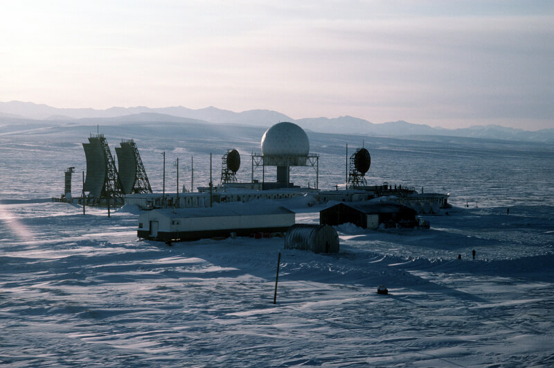
A Distant Early Warning Line station at Point Lay, Alaska. [Wikimedia]
The initiative to expand North America’s air defence architecture was announced on Feb. 12, 1947, and eventually led to the creation of the Distant Early Warning (DEW) Line.
The DEW Line stretched for 4,800 kilometres with more than 60 crewed radar stations, making it a potent deterrent to Soviet threats. It was referred to as a “triumph of scientific design and logistical planning” by the Arctic Institute of North America.
An early-1950s study by the Massachusetts Institute of Technology found North America was susceptible to Soviet air attacks from the north. The threat pushed the U.S. to pay for and construct the warning system, and, in turn, Canada allowed the Americans to access the Canadian Arctic. Construction started in 1954, and more than 25,000 workers played a role in building radar sites, roads, towers and more.
The first phase was finished in less than three years and the DEW Line extended from northwestern Alaska to eastern Baffin Island in present-day Nunavut. Connected to Alaska’s Aleutian Islands and Greenland in 1961, the DEW Line was capable of detecting potential Soviet air strikes early, allowing time for Canada and the U.S. to intercept potential bombers or intercontinental ballistic missiles, and help keep North American airspace safe.
Advertisement


